The Inca Trail to Machu Picchu is one of the most iconic treks in the world, offering a unique blend of history, culture, and breathtaking landscapes. Whether you’re planning a 2-day or 4-day trek, understanding the day-by-day itinerary and having a clear map of the route can help you prepare for the adventure ahead. In this article, we’ll provide a detailed breakdown of the classic 4-day Inca Trail itinerary, highlight key landmarks, and share tips to make the most of your journey.
Overview of the Inca Trail
The Inca Trail is a 43-kilometer (26.7-mile) trek that takes you through diverse landscapes, from high-altitude mountain passes to lush cloud forests. Along the way, you’ll encounter ancient Inca ruins, stunning vistas, and a sense of accomplishment as you approach the iconic Sun Gate and Machu Picchu. Here’s what you can expect on each day of the trek:
Day 1: Cusco to Wayllabamba
- Distance: 12 kilometers (7.5 miles).
- Elevation Gain: 300 meters (984 feet).
- Starting Point: Km 82 (2,720 meters / 8,923 feet).
- Ending Point: Wayllabamba (3,000 meters / 9,842 feet).
Highlights:
- Km 82: The official start of the Inca Trail, marked by a checkpoint.
- Llactapata Ruins: An ancient Inca site with terraces and stone structures.
- Scenic Views: Lush valleys, the Urubamba River, and snow-capped peaks.
What to Expect:
- The first day is relatively easy, with a gentle ascent and plenty of time to acclimatize.
- You’ll pass through small villages and enjoy stunning views of the Andes.
Day 2: Wayllabamba to Pacaymayo
- Distance: 11 kilometers (6.8 miles).
- Elevation Gain: 1,200 meters (3,937 feet) to Dead Woman’s Pass, then a descent.
- Starting Point: Wayllabamba (3,000 meters / 9,842 feet).
- Ending Point: Pacaymayo (3,600 meters / 11,811 feet).
Highlights:
- Dead Woman’s Pass: The highest point on the trail at 4,215 meters (13,828 feet).
- Panoramic Views: Breathtaking vistas of the surrounding mountains and valleys.
- Descent to Pacaymayo: A steep but rewarding downhill section.
What to Expect:
- Day 2 is the most challenging, with a steep climb to Dead Woman’s Pass.
- Take it slow, stay hydrated, and enjoy the sense of accomplishment at the summit.
Day 3: Pacaymayo to Wiñay Wayna
- Distance: 16 kilometers (10 miles).
- Elevation Gain: Mixed ascents and descents.
- Starting Point: Pacaymayo (3,600 meters / 11,811 feet).
- Ending Point: Wiñay Wayna (2,650 meters / 8,694 feet).
Highlights:
- Runkurakay Pass: The second-highest point on the trail at 3,980 meters (13,057 feet).
- Sayacmarca Ruins: A well-preserved Inca site with stunning views.
- Phuyupatamarca: Known as the “Town Above the Clouds,” this site offers panoramic views.
- Wiñay Wayna: A beautiful Inca ruin with terraces and waterfalls.
What to Expect:
- Day 3 is long but rewarding, with a mix of ascents, descents, and Inca ruins.
- The trail takes you through diverse landscapes, including cloud forests and mountain passes.
Day 4: Wiñay Wayna to Machu Picchu
- Distance: 6 kilometers (3.7 miles).
- Elevation Loss: 400 meters (1,312 feet).
- Starting Point: Wiñay Wayna (2,650 meters / 8,694 feet).
- Ending Point: Machu Picchu (2,430 meters / 7,972 feet).
Highlights:
- Sun Gate (Inti Punku): The iconic entrance to Machu Picchu, offering your first glimpse of the citadel.
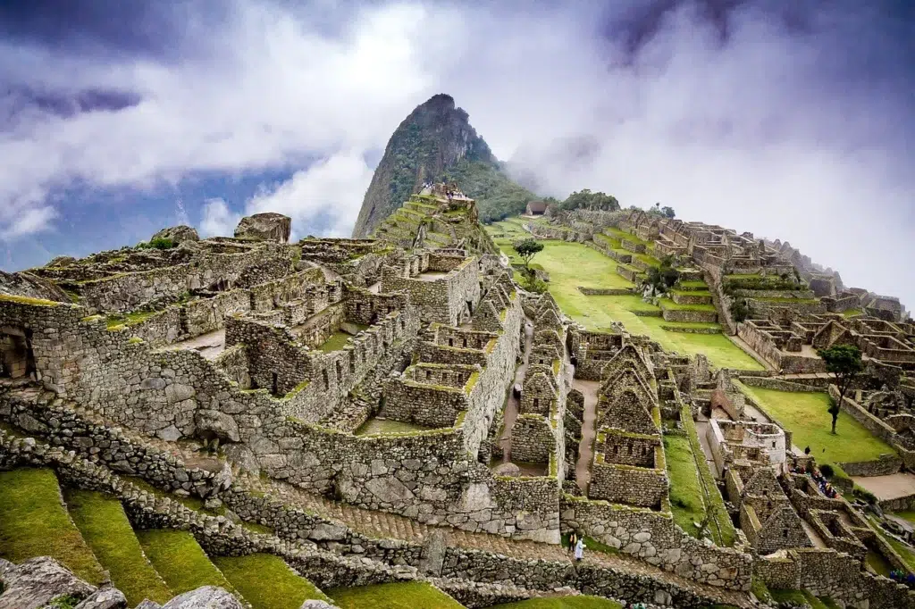
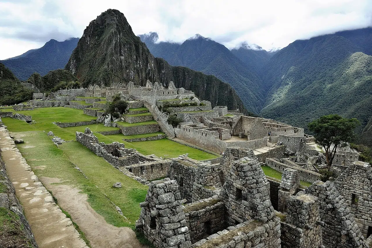
- Machu Picchu: The crown jewel of the Inca Trail, a UNESCO World Heritage Site and one of the New Seven Wonders of the World.
What to Expect:
- The final day starts early, with a pre-dawn hike to the Sun Gate.
- You’ll arrive at Machu Picchu in time for sunrise, followed by a guided tour of the site.
Inca Trail Map
While detailed maps are often provided by tour operators, here’s a simplified overview of the route:
- Km 82 to Wayllabamba: A gentle ascent through valleys and small villages.
- Wayllabamba to Dead Woman’s Pass: A steep climb to the highest point on the trail.
- Dead Woman’s Pass to Pacaymayo: A steep descent into a lush valley.
- Pacaymayo to Wiñay Wayna: A mix of ascents, descents, and Inca ruins.
- Wiñay Wayna to Machu Picchu: A final hike to the Sun Gate and Machu Picchu.
Tips for Making the Most of Your Inca Trail Itinerary
- Acclimatize Properly: Spend at least 2-3 days in Cusco or another high-altitude location before starting the trek.
- Pack Smart: Bring lightweight, moisture-wicking clothing and essential gear like a headlamp, trekking poles, and a reusable water bottle.
- Stay Hydrated: Drink plenty of water to combat the effects of altitude.
- Pace Yourself: Take it slow, especially on Day 2, and listen to your body.
- Capture the Moments: Bring a camera or smartphone to document the stunning landscapes and ruins.
- Respect the Trail: Follow Leave No Trace principles and respect the cultural and natural heritage of the Inca Trail.
Final Thoughts
The Inca Trail to Machu Picchu is a once-in-a-lifetime adventure that combines physical challenge, cultural immersion, and natural beauty. By understanding the day-by-day itinerary and having a clear map of the route, you’ll be well-prepared to tackle this iconic trek. Whether you’re marveling at the views from Dead Woman’s Pass or exploring the ancient ruins of Machu Picchu, the Inca Trail offers an unforgettable journey through history and nature.


